
SkyGeo
SkyGeo measures deformation dynamics anywhere on the surface of the planet. Engineers and asset managers use our products to understand millimeter-scale movements over reservoirs, pipelines, dams, dikes, railroads, bridges, storage tanks and entire cities.
SkyGeo's satellite measurement technology has the following advantages:
• Millimeter accuracy measurements
• Large scale monitoring (cost efficient)
• High spatial/temporal measurement density (cost efficient)
• Global data availability
• Data dating back to 1992; looking back in time
Contact Details
SkyGeo
Oude Delft 175
2611 HB Delft
The Netherlands
Active in
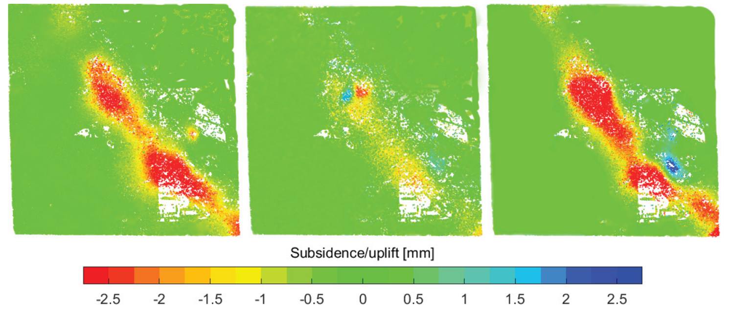
Samples of a SkyGeo surface subsidence and uplift map over a reservoir for 3 different time periods.