
VanderSat
VanderSat provides near real time worldwide soil moisture information with unparalleled resolution, derived from satellite data. Unique algorithms and methodology (patent pending) enable VanderSat to improve soil moisture pixel size from 25km x 25 km to 100m x 100m anywhere, updated daily. In other words, spatial resolution will improve by a factor of 62.500 . Rather than focusing on crop yield or weather forecast models themselves, VanderSat improves the quality of the key input data of those models, thus boosting the performance of all prediction models.
Contact Details
VanderSat
Huygensstraat 34
2201 DK Noordwijk
The Netherlands
Active in
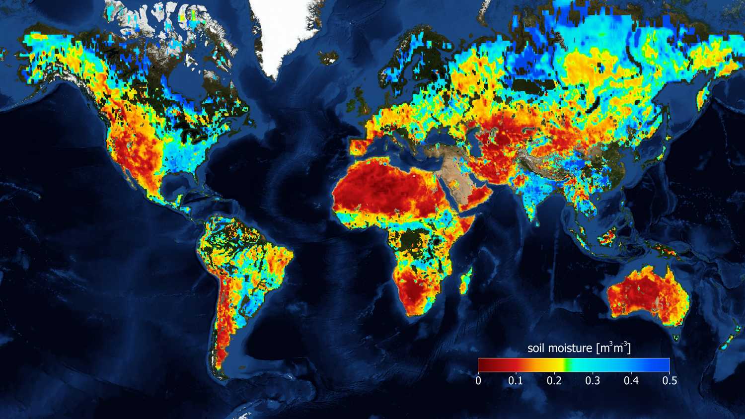
VanderSat improves soil moisture resolution by a staggering 62.500 times.
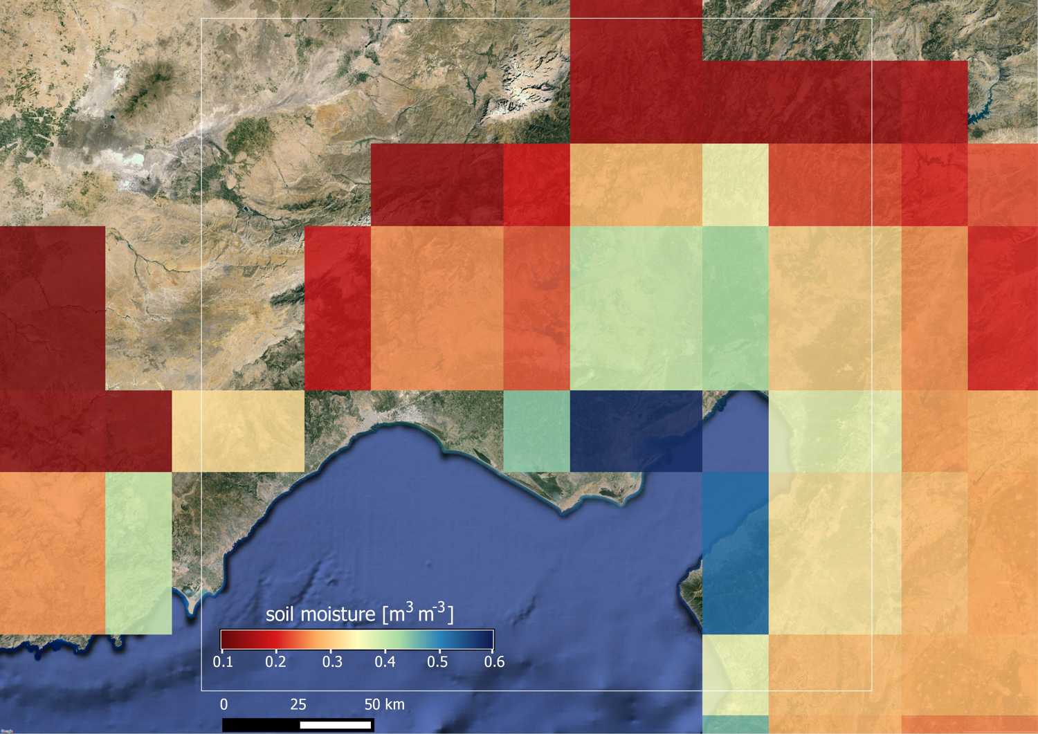
This is the current best practise applied to an area in Turkey. No good for operational services
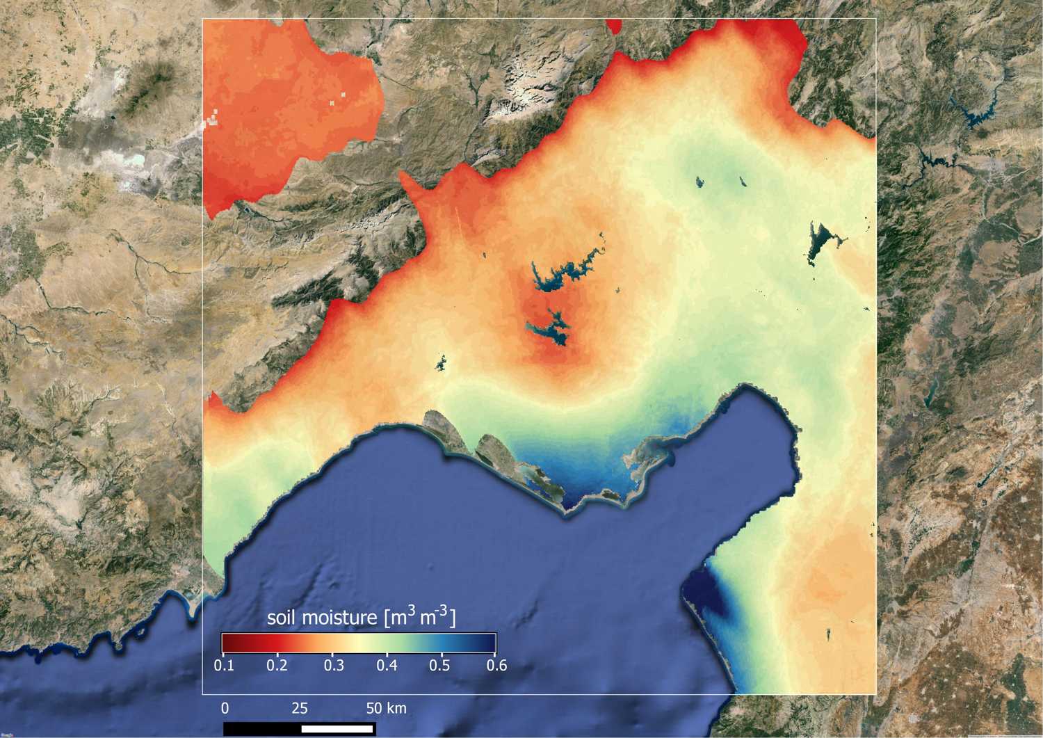
This is patented VanderSat technology, soil moisture can now be used in day to day business
We can see soil moisture on a field level, no model, actual observations
We are part of the Horizon 2020 programme